
Have you ever wondered how the boundaries of the Trinity Royal Conservation Area were decided? The boundaries are purely arbitrary and, I can only assume, were voted on by the Heritage Review Board when it was first established in 1982 or by some other elected body that the citizen’s of Saint John put their trust in at that time. Read Wikipedia info HERE
Below is a section of the Trinity Royal map showing King’s Square and surrounding properties. Can anyone explain why one side of King Street falls in the preservation area and one side does not? Especially since our beloved City Market falls on the side that is not considered “conservation”?
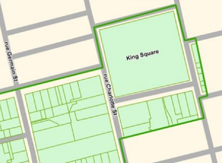
Figure A – Section of Trinity Royal Conservation Area
The point I’m trying to make here is that the corner of King Street and Charlotte (The former Woolworth’s Building) is zoned for up to 20 stories. You might wondered why Irving Oil didn’t choose to build on that corner. I assume it boils down to economics since they already owned the land next to the theatre.

Figure B – Map showing 91 King Street in relation to IOL site
Given that A) a developer could build a 20 storey building directly across the square from the IOL site and B) the IOL site is at the very edge of the area deemed for conservation (and not smack dab in the middle) are factors that, in my opinion, make a strong argument for why the Heritage review board granted the variance in the first place and for why their decision should be upheld.
There’s a rally (organized by Bob McVicar & Janice Purdy) being held at King’s Square this Friday (April 8th) starting at 11:30 am to urge the appeals board to deal with the issue of the appeal swiftly. A petition to this effect will be circulated at the event. If you cannot attend the event you can sign the petition on-line HERE
